Aerial photo of
a turlough near Gort,
Feb 2014


The aerial photo here shows a turlough at a townland called Roo approx
two and a half miles west of Gort Co Galway.
A turlough is a depression on limestone ground that is normally dry but in
wet weather and as the water table rises it perculates through the cracks
and fissures of this permeable rock to form a temporary lake.
As there has been a prolonged wet spell since the start of 2014 the water
table is rising to a point where the water in these temporary lakes are
threatening to flood nearby properties.


Camera; Digital
Photo; February 10th 2014
Stock library image file # dr_f6_6912

Ballyvoher turlough near Gort
More 2014 images of flooding
Shannon flood at Castleconnell flooding near Athlone  
Shannon flooding at Castleconnell, Co. Limerick
File # dr_f6_6785
Newtownflood, Roscommon
File # 1dsm3_f3_7297
 
More flood photos from 2009
Owenbue river overhead Halfway Bandon flood Riverview and Lidl Cork Flood 2009
Flood, Owenabue River
File # dr_f4_4836
Bandon, Riverview S.C., Lidl
File # dr_f4_4718
Cork, western approach
File # dr_f4_4850
Ireland 
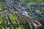
Aerial Photography,
John Herriott photography, Kilbeg, Bandon, West Cork, Ireland
© website and content 2006 to present
t. +353 23 8841455    |    f. +353 23 8852353    |    m. +353 86 8110280    | info@irelandaerialphotography.com
Home   :  Categories  :  Clients  :  Library   :  Sitemap  :  Contact  :  Commissions  :  Links